
It's day 184...It's also November 06, 2019......and we are in Meadview Arizona!
Podcast episode #29 Transcript
Dougie, Billie, and Craig
11/6/201911 min read
It's day 184...It's also November 06, 2019......and we are in Meadview Arizona!
Sooooo.....with the lights of Las Vegas in the rearview......we drove 37 miles up the road for a look at Hoover Dam....and some learning. Drove across the dam into Arizona but the road out at the top of the dam was closed (for the season I guess?), so we made the trip back across the dam, back into Nevada then into Boulder City.
Having learned so much about the construction of The Grand Coulee Dam in Washington....was curious to learn about the construction of the dam that creates Lake Mead....one of the largest artificially created lakes in the world.....and certainly, the largest in the US....as measured by water volume.
As I had learned while in Las Vegas....construction on the dam began in 1931 and had a huge economic impact on the area ... helping to create thousands of jobs during the Great Depression.
The Dam is located in the Black Canyon of the Colorado River, on the border between Nevada and Arizona and was built for power generation, flood control, water storage, and irrigation.
It is a concrete arch-gravity dam, which means it uses both the weight of the concrete and the arch shape to hold back the water of the lake it creates.
And the dimensions of this dam are insane....for a structure built using the technologies that existed nearly 90 years ago! 726 feet high and 1,244 feet long at the crest. The base of the dam is 660 feet wide.
Construction of the dam required 4.4 million cubic yards of concrete, 88 million pounds of plate steel and outlet pipes, 6.7 million pounds of pipe and fittings, and 45 million pounds of reinforced steel.
The project employed thousands of workers, but also holds the unfortunate distinction of being one of the deadliest construction projects in US History. Nearly 100 workers lost their lives during the construction of the dam in incidents ranging from rock slide activity and blasting accidents......to drownings and heavy equipment fatalities.
Initially called Boulder Dam, it was later renamed Hoover Dam in honor of President Herbert Hoover.
Much like the installation of most every dam constructed in the era......Engineers first had to figure out how to divert the Colorado river during the build. In the case of Hoover dam...50ft in diameter tunnels would be drilled through the canyon walls to reroute the river......around the 5 year build site.
Super interesting to read that the massive amounts of concrete used in the dam was poured in sections and cooled by a network of pipes filled with ice-cold water and without this cooling process, the concrete would have taken over 100 years to cool , and cure naturally.....if poured all at once.
Upon completion....The dam's power plant houses 17 turbines with a total capacity of 2,080 megawatts⁴. The electricity generated is distributed to Nevada, Arizona, and Southern California......and from what I have read....places the dam on the list of top power producing facilities (hydro that is) is the US. Looks like the Grand Coulee dam in Washington state still sits at the top of that list producing nearly double the amount of electricity annually.
And Lake Mead......the lake created by the dam would end up extending 115 miles upstream.
While researching the dam....I found this video.....Thanks to the B1M on YouTube for putting together a great visual of this monumental accomplishment.
Insert Video
Driving down through Henderson, and Boulder City we would see entrances to the Lake Mead National Recreation Area....a massive 1.5 million acres offering everything from desert hiking and biking....to beachside experiences on the shores of either Lake Mead....or Mohave Lake. The area offers nearly 1000 campsite opportunities....and regardless of whether your looking for a place to pitch a tent.....or park the RV.....they've got ya covered. Pretty safe bet we'll be back here for a more extended stay.
On the way back down we found a great spot in Boulder City and considered spending the rest of the day there…but a quick look at the map and I spotted a place called Kingman just 80 miles away in Arizona. With a fuel price drop of around 40 cents per gallon from Nevada to Arizona….I figured Kingman was as good a place as any to call it a night. It was a good call because when it comes to history…Kingman does not disappoint.
In 1857 the US War Department ordered a federal wagon road be built across the 35th parallel. The objective was to provide a trade route between Arkansas and California. As a part of the study that was done leading up to the installation of the federal wagon road…they also tested the feasibility of the use of camels as pack animals in the southwestern desert….later the study would lead to the United States Camel Corps...a program that was later abandoned. These wagon roads ran through the area that would become Kingman. They would later become part of Highway 66 and Interstate Highway 40. Remnants of the wagon road can still be seen in White Cliffs Canyon in Kingman.
I went back a read a little more about this US Camel Corp....another example of American history I knew nothing about. It turns out....the use of camels had been proposed as early as the 1830's. The idea that using camels for military purposes would be tested in areas all across the southern United States from Florida all the way across the country to the desert regions of the southwest.
The program wouldn't really gain traction until 1855 when the US Congress would a lot 30,000 dollars to the project and the task of procuring the camels would begin in earnest. Military personnel would be dispatched to the Mediterranean to acquire 33 camels from countries like Turkey, Egypt and Tunisia.
The 33 camels would arrive in Indianola Texas in 1856 and deployed in expeditions to test their effectiveness in the harsh desert environments. The camels proved to be hardy and well-suited for the terrain, capable of carrying heavy loads over long distances without much water.
The program would begin it's decline at the start of the civil war in 1861. Clearly the US military focus had shifted dramatically and the Camel Corp would be officially disbanded in 1866. Some of the camels were used in private enterprises.....but most were sold at auction and a few would even be left to roam in the wild.
And back to Kingman.....the town itself was founded in 1882 as a railroad town for the Atlantic and Pacific Railroad. It was named after Lewis Kingman, a civil engineer who supervised the construction of the railroad from Winslow to Beale Springs.
The town became the Mohave County seat in 1887³, growing into a significant supply and shipping center for miners and ranchers in western Arizona³. During World War II, Kingman was home to a U.S. Army Air Force airfield, which trained around 35,000 soldiers and airmen².
With a population of around 30k today... the towns economy is driven by tourism, manufacturing, distribution, and transportation¹. The city's location along Historic Route 66 and its proximity to natural attractions like the Hualapai Mountain Park and Lake Mead National Recreation Area contribute significantly to its tourism industry¹.
And this was not my first run in with that historic Route 66....a likely will not be our last. But what better place to learn about a highway that has become legend in the United States.
Route 66 was established on November 11, 1926 as part of the original US hiway system. It originally ran from Chicago illinois to Santa Monica California....covering a total of 2,448 miles. The route would pass through eight states.....Illinois, Missouri, Kansas, Oklahoma, Texas, New Mexico, Arizona, and California.
The Route quickly became a major path for those migrating west....especially during the Dust Bowl, and Great Depression of the 1930's. It supported the economies of the communities it passed through, leading to the development of numerous businesses such as motels, diners, and gas stations.
As the country emerged from the Great Depression, and fought to victory in a second world war....the highway would gain iconic status and would symbolize the freedom of the open road....and a lifestyle being crafted in the United States that the rest of the world would come to envy. John Steinbeck would refer to the highway in his Best Selling Novel "The Grapes of Wrath" as the road of hope and escape. It would be further popularized in song .....Get your kicks....on Route 66! It would even lend it's name to the popular 60's TV series...."Route 66" .... the show would chronicle the adventures of two young men that traveled the country in a Corvette Convertible....further epitomizing the glamour of the open road during the automobile era in the American West. In season one of the show the Corvette was a powder blue 1960 model....the model of the car progressed with the series culminating in the iconic Corvette Stingray.
Installation of the Countries interstate system throughout the 50's and 60's would lead to the decommissioning of Route 66....but it's history and legacy would be preserved with it's designation as an historic Route. Today it is huge draw for tourists looking to experience a bit of Americana....and a bygone era.
Closing the laptop this evening, parked in an open lot, across from a Home Depot....and surrounded by an array of fast food resteraunts, dentists offices and office buildings.....Dougie and I walked the streets of Kingman Arizona pondering the contrasts......the contrasts posed by growth.....considering the differences between what we see today.....and a community just 70 or so years ago....flourishing amidst the growth of a nation after the second world war...and embracing life along Route 66....and what that looked like.....or even 100 years before that when the area was traversed by wagon trains....and introduced to the nations railway systems......and perhaps even a camel or two.
All this history.....deep in America's southwest....
The following morning we would head out of town... on Stockton Hill Road.....a two lane road that runs from Kingman to Pierce Ferry Road about 60 miles out....and then on to the Grand Canyon Skywalk. While I have not been on this side of the grand canyon before......since the completion of the Skywalk...I have seen the canyon a couple of times....so I decided to head in a different direction...and save the visit to the skywalk for another time. Winding through the Valley between the Music Mountains and the Cerbat Mountains....the landscape would shift rapidly from wide open high desert....to Joshua Tree forests lining both sides of the road.....these are not the forests I am used to......Josua Tree's are a member of the Yucca family....and thrive in the desert surroundings.....and most all Joshua Tree's in the US are found right here....in this part of the country. The Joshua Tree Recreation area in Southeast California is likely one of the best known Joshua Tree Forests.
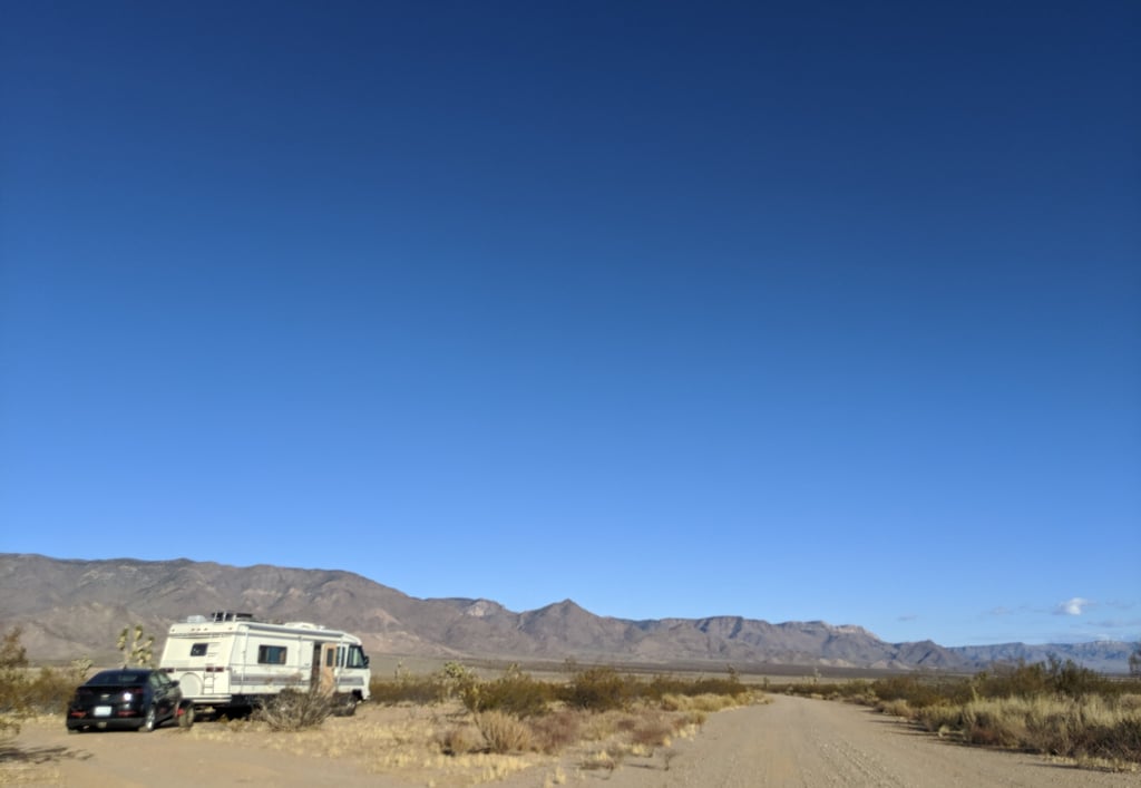
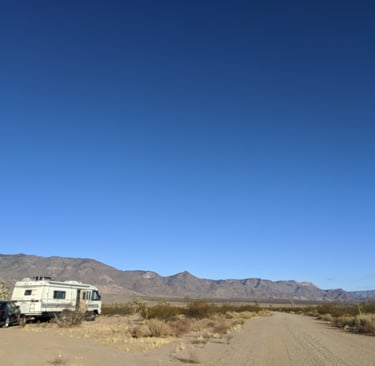
We weren't even 70 miles from Kingman when....it happened again! Our next two nights, amidst a Joshua Tree forest would be spent alongside a dirt road named Lucy Lane....a road not even designated on our map. And by now....you likely know we rarely pass by a dirt road.....or a cattle guard. A quarter of a mile or so off Stockton Hill Road, on Lucy lane we would be presented with a large turn out....just big enough to squeeze Vacilando into and get situated for our next adventure....and some more learning!
It's pretty awesome when Google Maps can't even make up it's mind where we are. I checked out our location on Google Earth....it seemed to think we were in Meadview.....but when I asked my phone for directions to Meadview...it directed us 19 miles south. But wherever we are....it would be an awesome two days of walking the desert among Joshua Tree's....looking out over the farmland in the distance while shaking sand out of my flip flops....and watching the personality of the landscape change countless times throughout the day.
For two days and nights.....we would watch the lighting shift the deserts personality. The mountains shifted from deep brown…almost black in the morning and lighten through the day taking on a red hue that intensified as the sun set. The clouds rolled over amazingly fast…which explains all the signage warning of flash flood danger.
Having passed so many signs warning of potential flash floods I wanted to understand how this high desert area...averaging some 4 thousand feet in elevation....could potentially experience flooding....and what would drive that...
I would learn that this area.....like many parts of the Southwest, is prone to flash floods....and there are several factors...
First....Monsoon Season. During the summer months, the North American Monsoon brings intense thunderstorms to the region. These storms can produce heavy rainfall in a short period.....overwhelming the dry, hard ground that cannot absorb water quickly. The landscape is rugged and mountainous...with narrow canyons and dry riverbeds known as arroyos....or washes. When heavy rain falls, it runs off quickly into these channels, creating fast moving torrents of water.
Wildfires can also contribute. Burned vegetation and ash create a hydrophobic layer on the ground....making it even less absorbant....increasing the runoff and more severe flash floods.
The Sudden nature of the storms in general....even if they occur miles away.....has lead to the term Flash Flood. Large amounts of run off travel down through the washes or arroyos catching folks in lower elevations off guard.
Meadview itself is an unincorporated community..... It was actually established as a retirement community in the 1960's....and continues to draw retiree's to this day. The current population of 1400 may be mostly made up of retiree's.....but families and converted vacationers all call Meadview home today....and for all the same reasons....
The community is nestled on the Grapevine Mesa, a high desert plateau providing stunning views of the Grand Wash Cliffs, and the surrounding Joshua Tree Forest.
The natural beauty, combined with the mild climate, and it's proximity to Lake Mead and the Grand Canyon make the area a popular stop for thousands each year.
It also doesn't hurt that The community is surrounded by federal land, including the Bureau of Land Management (BLM) and National Park Service (NPS) areas, which helps preserve its natural charm, and ensure population won't be an issue anytime soon. As you can imagine.....residents and visitors alike can enjoy a variety of outdoor activities such as boating, fishing, hiking, and stargazing, thanks to the area's dark sky ordinances.
A dark sky ordinance ? First time I'd ever read that term.....and Meadview has them! It is a regulation designed to reduce light pollution, preserving the natural night sky for both residents and visitors. In Meadview, Arizona, this ordinance helps maintain the area's pristine nighttime environment, making it a popular spot for astronomers and night sky enthusiasts.
The key aspects of a dark sky ordinance typically include:
- Limiting Outdoor Lighting: Restrictions on the amount and type of outdoor lighting to minimize glare and light trespass.
- Shielding Lights: Requirements for lights to be shielded so that they direct light downward, reducing skyglow.
- Curfews: Setting times when outdoor lights must be turned off or dimmed to reduce light pollution during late hours.
Given that it is a term I had never heard....it was even more interesting to learn that dark sky ordinances are enforced in 19 states across the country.....and not surprise I suppose to learn that Arizona is at the top of the list when it comes to more aggressive dark sky ordinances....along with places like Texas, Pennsylvania, Colorado....even California...believe it or not.
It became pretty obvious to me that the folks in Meadview appreciate the beauty of their surroundings....working hard to preserve the pristine nature of the area....all while offering a wide range of amenities and social groups, such as the Friends of the Joshua Tree Forest, South Cove Kayakers, and Meadview Ridge Riders ATV Club, which help residents and visitors connect with, and enjoy the area's unique offerings.
Our last night here I fell asleep watching the headlights of cars some 20 miles away glide down the hillside to the north, weaving in and out of view into the valley…then passing us just far enough away to be seen but not heard
It's sheer Bliss I thought....as I whispered.....Good night Arizona.