
It's day 193.....it's also November 15, 2019......and we are in Vicksburg Arizona
Podcast episode #31 Transcript
Dougie, Billie, and Craig
11/15/201910 min read
It's day 193.....it's also November 15, 2019......and we are in Vicksburg Arizona
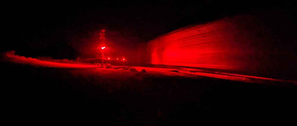
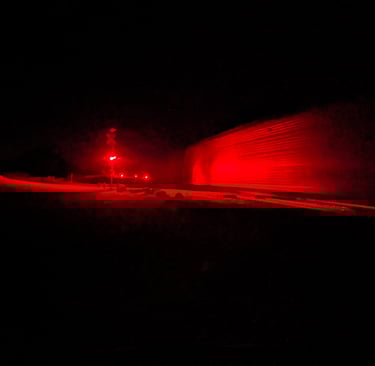
As the saying goes.....Time flies when your having fun.... Reality crashed our camp yesterday when I realized we were running low on fresh water. Since we had to pack up and go fill up…figured we might as well go do some more exploring, so explore we did. Down 95 past the Parker Dam. Up through the foothills into Parker and driving through the Colorado River Indian Reservation. Just south of Parker we took Highway 12 to 14 and went out through a place called Bouse. As darkness fell we stopped at the Bouse Community Park to fill up with water, then head out on highway 72 in search of the next cool campsite. We’ve managed to strike gold from time to time…and find an amazing campsite after dark…tonight would not be one of those times. We pressed on until we reached Vicksburg…when I saw what looked like a large graveled area just off to the right. I pulled off onto it and as Vacilando’s headlights swung around I saw a massive wall of movement. As I slowed to a stop the senses hit me all at once…and hit pretty hard. Visually…I realized that wall of movement was actually a sea of cows…heads bobbing and the occasional white face reflecting in our headlights, not to mention all those big brown startled eyes. The sense of smell simultaneously confirmed what I was seeing. I could hear voices barking out orders…echoing from covered and lit facilities well back behind the faces in our headlights. No doubt the cowboys shutting things down for the night and prepping for the morning…when a steady stream of stock trucks would roll over that very gravel lot where we were sitting. It was obvious we had wandered into the staging area for a stock yard? Obviously we did not stay long…but I did observe, and listen long enough to ponder how long it had been since I’d witnessed my next hamburger or steak in this form. Still very much alive, and being staged for shipment, for processing and ultimately destined for the supermarket shelf, nicely sterilized and packaged for me to study fat content and price per pound before selecting. But not for a second considering the surroundings in which I currently sat…looking eye to eye into my future hamburger. A run back by there the next morning would show that these particular bovine were of the dairy variety…same difference…I rarely look beyond the expiration date on a carton of milk these days…let alone think about the facility from which it came….or that the facility might be in the Arizona desert.
It is now well into the night, and I’m tired of drivin…so we headed on out a little further to where I knew we would find Interstate 10…and the obligatory truckstop. As predicted…just up the road a patch I-10 passes through carrying an endless river of every imaginable type vehicle in and out of the Phoenix metro area some 100 miles to the east…and indeed…that obligatory truck stop was there. We pulled in around a couple dozen semi’s…dodged some super huge pot holes and took our spot at the back of that big patch of dirt. After a walk..we settled in for the night and as I drifted off to sleep amidst the hum of the semi’s wrapping us safely on three sides…tucking us in for the night…into that desert just to our right…I thought how I wasn’t quite ready to drive head first into those 5 million or so folks in the Phoenix metro area. I was not sure what direction we would go in the morning…but I was fairly certain it would not be east.
The following morning we awoke to silence. Rolling up the blinds and getting a pot of coffee on.....we'd find ourself all alone on that big patch of dirt. Apparently the semi's around here are on a tight schedule and were off to an early start. The lot full of semi's we had gone to sleep amidst....was empty.....it was just us. I manuevered Vacilando a few hundred feet out to a corner of the lot....adjacent a small patch of desert....where Dougie and I would embark on our first walk of the day.
The first thing we would notice...was all the trash. We had spent so much time in recent months so far from large populations....that it was a dissappointing reminder of what happens to the landscape when you inject a few million humans.
None the less.....decided we'd stick around here for the morning....having some breakfast....and do some reading about the area's we had passed through over the 85 miles traveled from Lake Havasu City.....
First up....Parker Arizona. The place for which the Parker Dam was named.
Located just 38 miles from Lake Havasu...and situated on the Colorado River.....no surprise to read that the are was originally inhabited by the Mohave people.
The Mohave people are part of the Yuman speaking tribe and are believed to have migrated to the area from the Northwest over 1000 years ago. They would inhabit this part of the Mohave desert for centuries...primarily as agriculturalists, growing crops such as corn, beans, and squash along the fertile banks of the Colorado River. They also engaged in fishing, hunting, and gathering. The river was central to their way of life, providing water for irrigation and a means of transportation.
They were also known for their distinctive pottery, basketry, and tattoos. They had a rich oral tradition, with stories and songs passed down through generations. Their social structure was organized into clans, and they had a complex system of governance and spiritual beliefs.
The town of Parker was founded in 1908 as a railroad town. The town was named after Ely Parker, a Seneca attorney, engineer, and the first Native American commissioner of Indian Affairs. The town's establishment was closely tied to the construction of the Arizona & California Railway, which aimed to connect the region to larger markets. In addition to the transportation services in the area...the town would also serve as a mining hub. Mining activity around Parker has been quite extensive. Records indicate that nearly 11,000 mining claims were filed in the area and over 300 actual mines were once in operation....with the primary minerals being copper, gold, silver, and iron. This activity would begin in the late 1800's with the discovery of gold....and last nearly a century with the last mines closing operation in the late 1900's.
As transportation and mining became less viable in the area....the installation of the Parker Dam....and creation of Lake Havasu.....would take their place which brought flood control, as well a a steady water supply...helping to drive the agriculture and tourism industries in the area.
Parker would even play an important role in the war effort during WW2. It was home to a large training facility for the US army...with power generation at the nearby dam helping to sustain the effort.
In the 80 or so years since the installation of the dam....the community has grown to around 3000 with an economy pretty steadily based in tourism, agriculture and services. The nearby recreational opportunities around the Colorado River....and Lake Havasu continue to draw not only tourists....but a retirement community looking to enjoy all that outdoor activity. On the agriculture front...you'll find things like cotton, alfalfa and a thriving melon industry.
After Parker.....we passed through a place called Bouse.
Our stop here to fill the water tanks might have led to a longer stay....had we been equipped with a four wheel drive vehicle. The gentleman manning the community center where we stopped told us about the areas use as a top secret training facility during WW2. He said you can drive out to the camp checking out the remnants of a camp that once housed over 20,000 soldiers.....but that many of the roads could get pretty sandy so would not recommend doing it without 4 wheel drive. We may not have been able to check it out in person....but I certainly wanted to read more about this Top Secret Facility.
And that reading would tell us that the area would first be referred to as Brayton. John C Brayton was the owner of the Brayton Commercial Company and arrived in the area in 1906. He ran successful Mercantile and Supply depots in mutltiple towns in the area. The name of the town would officially become Bouse with the naming of the post office and it's official incorporation in 1908.
The area would remain a hub for the areas miners until WW2....when things would take an interesting shift for the town...
In Augus of 1943, the US Army would secure over 20 million acres of the Arizona desert in order for the 369th Engineer Battalion to build camp Bouse. The camp's purpose was designed to train troops on a highly classified project known as the Canal Defense Light (CDL). This involved using a 150,000 lumen carbon arc lamp mounted on M3 tanks to temporarily blind and disorient the enemy at night. For reference...the average street light today produces around 25,000 lumens....your cars LED headlights.... somewhere between 3 and 6000 lumens. The project was so secretive that leaking information could result in imprisonment or even execution under the Espionage Act of 1917. The camp's remote location and strict security measures ensured its activities remained confidential. Several tank battalions, including the 526th Armored Infantry Battalion, the 554th Ordnance Heavy Maintenance Company, and the 9th Tank Group, were stationed at Camp Bouse¹². It is estimated that between 20 and 30 thousand soldiers operated, and trained at the camp. The completed camp would include it's own 500,000-gallon water reservoir...to serve as a water supply for the camps activity.
Camp Bouse would be shortlived. While testing was successful....the specially equipped tanks would never be used in combat. It was decided that while the high power lights would indeed render enemies blind during night time conflicts.....they would also light up and other wise agile and stealthy tank making it an easy target for enemy aircraft....or troops armed with anti tank weaponry positioned in higher elevations around a battle field. ...but the technology developed to generate such intense lighting , I would guess, went on to be used eleswhere in the US Military. Troops would arrive at Camp Bouse in August of 1943....and the camp would be declared surplus by April of 1944.
Reports vary as to wether the camp was actually destroyed by the military....or simply abandoned ...leaving the camp to deteriorate in the harsh desert conditions to what can be seen today.....some 80 years later....which isn't much
These remnants...include that 500,000 concrete water catchment area....the occassional concrete foundation and walkway....with the center of the camp being marked with a Flag pole and US flag, light at night with solar powered lighting. The flag pole is maintained by local volunteers and history preservation organizations in the area. It's also said that you can still find tank tracks in the desert floor if you hike long enough.
Another new term I would learn when reading about Bouse today.....would be "Food Desert" A term coined in Scotland in the late 1990's.....and apparently has made it's way to the US....and Bouse....is in one
Food deserts are areas where residents have limited access to affordable and nutritious food. These areas can be found in both urban and rural settings and are often characterized by a lack of grocery stores, farmers' markets, and healthy food providers. Ironically....and sadly....their presence is also associated with area's of low income...area's in which individuals have poor access to affordable transportation, and area's of high unemployment.
Here in the US...Food deserts are growing all accross the country....particularly in rural areas as local grocery stores have gone under because they cannot compete with pricing of the corporate grocery chains in the larger communities. The challenge is that residents in the smaller communities do not always have access to reliable transportation which is important given that the larger stores.....and those lower prices.....are in most cases at least 20 miles away...and sometimes....much further. It is estimated that over 20 million americans currently reside in what is considered a Food Desert. It was interesting to read about the many effects this is having on communities all across the country...in many cases...even in communities that do have access to the larger stores....the grocery industry...and pricing .....forces low income folks away from the more expensive fresh and nutritous food options....and more towards the frozen food....or heavily processed foods that while may be more affordable....they are also known to contribute to the many health issues in the US today...including alarming rates of obesity in the country...which in and of itself....leads to a whole other list of health risks. An interesting topic....and one I'll likely spend more time on in the future....for now...just the heightened awareness of how grocery stores work in the country....and where they work....will be enough.
The hope would be that organizations....federal programs.....and even the grocery store industry in general be held accountable to the objective of making fresh,healty, and affordable foods available to every Amercian...regardless of where they live. I bet the 700 or so folks that call Bouse home today would agree.
And just 20 miles up the road.....we would find our spot on a truck stop parking lot in the place called Vickburg. Population 400.
Not unlike Bouse....and many communities in the area....Vicksburg would be established as a supply center for mining activity....as well as post office, and other support mechanisms for the local community. Here in Vicksburg....the community was named after Victor E. Satterdahl, a storekeeper who applied for its post office and served as the first postmaster when it opened in 1906.
Victor settled in the area primarily due to its potential for development and commerce. As a storekeeper, he saw an opportunity to establish that post office and serve the local community, which was essential for communication and trade in the early 1900s.....not to mention the revenue potential in the numerous mining claims and operations that were popping up in the area.
Today, Vicksburg remains a quiet community The local economy is primarily driven by a few key industries: Despite its remote location, Vicksburg has ongoing construction projects that contribute significantly to its economy. One notable project is the pavement rehabilitation on US 60 between Vicksburg Road and the State Route 72 junction¹². This project involves removing the existing pavement surface and replacing it with new asphalt concrete, along with other related improvements like replacing guardrails and pavement markings¹².
Such infrastructure projects are essential for maintaining and improving transportation routes, which are crucial for the movement of goods and people in and out of , and through the area. These projects create jobs and stimulate the local economy.
And that stockyard we wandered into last night.....it is The **Vicksburg Feed Yard... and it is is a significant facility playing a crucial role in the local agricultural and livestock industry here in Vicksburg.
We pulled out of that truckstop in Vicksburg late morning.....heading east.....knowing that the Phoenix metro area....and the over 5 million folks that call it home....was just 100 miles or so up the road.....
We wondered what we could discover......between here......and those 5 million people